KIXLEY LANE AND ELVERS GREEN
Kixley Lane runs from Golden End in Kenilworth Road to just beyond the canal. The
name is ancient: a field called Kixley Meadow was recorded as early as 1327 and still
appeared on 19th century maps. The lane once continued to Elvers Green Lane, but
was divided by the canal in 1799 and then closed off at the enclosures in 1820. As
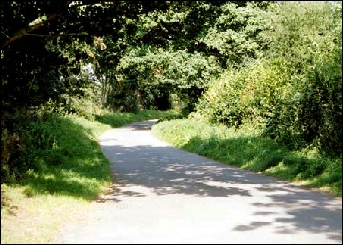
a result only a stone’s throw from the village centre, Knowle still has a delightful
country lane which has effectively become part of the footpath network. It peters
out into a field path beyond a picturesque canal bridge which leads to Elvers Green
Lane, where the ford across the River Blythe has provided a playground for Knowle
children for generations.
Before the church was built villagers had to go to the parish church at Hampton-in-Arden,
most of them on foot. The consensus of opinion is that they went down Kixley Lane,
along a path now replaced by part of the towpath, and joined Hampton Road at Waterfield.
There are paths at the end of the road just beyond the canal which support this
- and this section of the towpath is the only part which carries a public footpath.
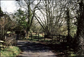
A short way along on the left is the National Trust Children’s Field, donated by
the village in 1910. Beyond is Knowle Church of England Primary School, a row of
attractive former council houses built between the wars and Yew Tree Farm. At the
end of the lane is a private house called Far End, which for a short time was a canal
pub called the Kixley Tavern. A little further along is The Cottage; beyond the
bridge is Kixley Farm and a field spring where a watercress patch still thrives.